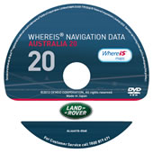

LAND ROVER AUSTRALIA AND NEW ZEALAND GPS MAP UPDATES
Land Rover - Australia 20 Update
P/N WISLANDROVKEY20
This product is now only available from your Land Rover dealer. |
 |
Price:
Au$275.00
Please contact your Land Rover Dealer
|
AUSTRALIA 20.0 | ||
| Population coverage | > 99% population* | |
| Points of Interest | 817,698 | |
The Whereis® Navigation Map Data provides a detailed digital road map guidance database for use in your vehicle navigation system. Australia 20 is Sensis latest database release for Land Rover, for more detail on the Australia 20 please see below:
VICTORIA MAP DATA FEATURES
- Approximately 219, 413km of road network.
- Including additional 77,750km with address ranges.
Major New Roads:
- Reconstruction of the Barwon Heads bridge at Barwon Heads.
- Cranbourne-Frankston Road Duplication (Hall Road to Western Port Highway), Cranbourne South.
- Duplication of a 2.1km section of Koroit Creek Road between Grieve Parade and Millers, Altona.
- Pound Road upgrade (Dandenong South).
- Widening of bridge over South Gippsland Freeway and additional lanes onto the South Gippsland Freeway.
- Realignment of road to create a direction connection with Fellmongers Road.
- Geelong Ring Road – Section 4B.
- A new 5km link from Anglesea Road south of Hams Roads top of The Princes Highway near Draytons Road.
- M80 Ring Road Upgrade (Calder Highway to Sydney Road).
- Upgrade of 38km Western Metropolitan Ring roads, from the Princes Highway near Draytons Road.
- Palmers Road overpass.
- Extension of Palmers Rd overpass to beyond the Princes Freeway and across the Werribee Rail line Sayers Rd duplication.
- Duplication of Sayers Road between Tarneit and Derrimut Roads Princes Highway upgrade (Wurruk to Sale).
- 4km of road to be reconstructed and duplicated between Reid Drive, Wurruk and Reeve Street, Sale.
AUSTRALIAN CAPITAL TERRITORY MAP DATA FEATURES
- Approximately 5,551km of road network.
- Including 2,162km with address ranges.
Major New Roads:
- Monaro highway duplication to create 2-way, 2 lane divided carriage ways between Canberra and Newcastle St, Fyshwick.
NEW SOUTH WALES MAP DATA FEATURES
- Approximately 253,892km of road network
- Including 78,473 km with address ranges.
Major New Roads:
- Construction of 3.1km Link Road between roundabout intersection of the Pacific Highway and Brittania Drive Wanobbi and Sparks Road and Albert Warner Drive , Warnervale.
- Widening of F5 Freeway from four to eight lanes between Camden Valley Way and Brooks Road.
- Camden Valley Way upgrade – Bernera Road to Cowpasture Road.
- Camden Valley upgrade – Narellan Road and Cobbitty Road, Harrington Park.
- Central Coast Highway upgrade – (Stage 1)Carlton Road to Matcham Road.
- A 54 kilometre section of Main Rd 92 (MR92) between Hames Rd (15km southwest of Nowra) and Nerriga is being upgraded.
- 4.5km of two lane road to be built with an additional 1.2km of southbound overtaking lane at Gounyan Curves.
- Woomargama Bypass – Construction of dual carriageway bypass on the Pacific Highway at Woomargama.
- 6km section upgraded to dual carriageway form Wrights road to the Pacific Highway, west of Port Macquarie.
- Pacific Highway 9.6km dual carriage way upgrade from Perrys Road to Lyons Road and included a bypass of Bonville.
- Tarcutta bypass (Hume Highway) –Construction of dual carriageway bypass on the Pacific Highway at Tarcutta.
- Banora Point upgrade, Pacific Highway -2.5km of six lane road including new interchange and realignment of Laura Street.
- Hume Highway – South Marulan interchange south of Marulan.
- Pacific Highway upgrade – Ballina bypass (southern intersection).
- Pacific Highway speed upgrades at three locations.
QUEENSLAND MAP DATA FEATURES
- Approximately 298,980km of road network.
- Including 64,788km with address rangess.
Major New Roads:
- Airport link Project.
- Beaudesert-Beenleigh Road and Tallagandera Road intersection.
- Gold Coast Highway upgrade (Labrador).
- Houghton Highway Duplication.
- Nicklin Way Caloundra to Minyama.
- Nicklin Way/Erang Street intersection upgrade.
- Olsen Avenue (Labrador-Carrara Road) upgrade.
- Redlands Corridor Program Section B: Mount Cotton, Broadwater and Duncan Road upgrade – Stage 1.
- Progress Road upgrade (Stage 2) – Upgrading Progress Road between Ipswich Motorway and Boundary Rd to a five lane corridor.
- Redlands Corridor program Section C Cleveland Redland Bay Road upgrade.
- Tilley Road extension (Stage 2 –New Arterial road).
- Bruce Highway duplication and intersection upgrades.
- Cardwell Range upgrade project.
- Douglas Arterial Duplication.
- Bruce Highway additional overtaking lanes.
- Townsville Port Access Rd –Section 2 Eastern Access Corridor.
NORTHERN TERRITORY MAP DATA FEATURES
- Approximately 34,432km of road network.
- Including 2,759km with address ranges.
Major New Roads:
- Berrimah Road Rail overpass – Construction of a four lane rail overpass at Berrimah Road, Wishart.
WESTERN AUSTRALIA MAP DATA FEATURES
- Approximately 210,763km of road network.
- Including 42,043km with address ranges.
Major New Roads:
- Coalfields Highway upgrade.
- Albany Highway upgrade – John Street to Leach Highway.
- Ocean Reef Road Extension.
- Reid Highway/Mirrabooka Avenue Overpass.
- Dunreath Drive Connection (Perth Airport).
- Great Eastern Highway /Roe Highway interchange.
- Hepburn Avenue Second Carriageway Construction.
- Tonkin Highway & Morley Drive intersection upgrade.
SOUTH AUSTRALIA MAP DATA FEATURES
- Approximately 123,907km of road network.
- Including 25 878km with address ranges.
Major New Roads:
- Main North Road name change to Horrocks Highway.
TASMANIA MAP DATA FEATURES
- Approximately 28,138km of road network.
- Including 10,272km with address ranges.
Major New Roads:
- New Roundabout and junction improvements on the East Derwent Highway, Hobart.
- East Tamar Highway upgrade including Dilston bypass.
- Construction of Dilston bypass on East Tamar Highway Illawarra main Road.
- Realign and regrade Illawarra Road at Longford.
